Dave is a bread fiend. One of the items we needed to satisfy this bread yen was some fresh rolls. Today's quest - find a bakery and get some rolls.
Don't ask us why, but we thought every town had a small bakery in it. So we headed from our cozy campground to Baker City, OR to find said bakery. Well, we discovered that there is no said bakery in Baker City, OR. (Safeway and Albertsons don't count.) So we pulled out our phones and did a search for a bakery in the area. According to the search, Kneads was open and located in La Grande, a mere 40 miles away. What the heck, other than visiting Anthony Lakr, we had nothing else planned so off we went, via a back road.
About 5 miles down the road, we came to Haines, a very (as in VERY) small community. As we are driving through Haines, we notice this hand painted sign. Dave missed it, so I had him turn around and follow the arrow and the next one three blocks down the road that pointed right.
Lo and behold, a bakery! And it was open. Bill the cat came to welcome us, taking a small break from catching moths in the garden.
While the building didn't look like much, Brianna had some bread and other baked goods that were quite enticing....what was left. Evidently, Friday is bread day and she only had a few loaves left. While they were not rolls, it was fresh whole wheat bread. We also indulged in a chocolate fudge sandwhich cookie that was to die for (sorry, we ate it before thinking about taking it a picture).
We had scrumptious bread "steaks", as Dave calls thick sliced bread, for dinner.
Never under estimate the delights at the end of the hand painted sign! If ever in Haines on Friday, stop and get your fresh baked goods. You won't be sorry.
Saturday, August 30, 2014
Thursday, August 14, 2014
Fairy Falls with a Bonus
After scoping out the park, we returned to Fountain Flats Drive to hike our first full hike. (We had done plenty of walking up to this point, just not to one destination.)
Fairy Falls is one of the scenic falls within Yellowstone that is photographed the most. There are 2 trails in - the one less traveled and the one where the trail head looks like 5:00 p.m. traffic on I-5 and I-90, in other words packed. We took the trail less traveled. It added about a mile to the overall hike, but it was worth every step. The trail is extremely level, so if you are inclined to walk 8 miles (round trip), consider this one.
Along the way were a variety of hot pools steaming up and signaling their whereabouts. It was wonderful to walk up to the pools and geysers without a) boardwalk boundaries, and b) hoards of tourists elbowing their way past to glam for a picture (very annoying). Around most of the pools, it is evident that the Bisons use the area as their winter home. What first looked, at a distance, like rocks turned out to be anything but....
Onward to the falls and lunch. Dave was pretty certain that we would be the only people at the falls. Ha! It turns out that the trail most traveled is also the trail taken by tour guides to bring folks to the falls. Kudos to them for making the trek. Happy to leave them and head back to our trail less traveled!
Before we headed back to the truck, I talked Dave into taking a .6 mile detour to Imperial Geyser. We had come this far, no sense in leaving any geysers not viewed! OMG. As we rounded the corner of the upper trail, we were greeted by an amazing view. Once around the corner, the view improved. The highlight of my day!
Wednesday, August 13, 2014
How do You See Yellowstone?
One section at a time!
Day 2 of exploration was via the Southern loop.
The majority of the geysers, including Old Faithful, are located in the Southwest. The east side includes the Hayden Valley, summer home of Bisons.
This was truly a day of identifying the "come back to" spots. But first, we stopped to enjoy Old Faithful. There was quite the crowd awaiting the show. It was a short, but powerful show.
On to the Hayden Valley! We were rewarded with a large herd of Bisons on both sides of the road. These two were away from the herd, as they headed away from a hot pool.
Back to camp to get ready for our hike the next day - Fairy Falls.
Yellowstone is amazingly huge. The advantage it has over Glacier
is the number of routes that can be taken to get to various parts of the park
(Glacier has one main road through the center of the park). So while there are many people and cars
within the park, traffic is never truly at a standstill, unless of course, there is a
wildlife sighting along the road.
The loop around the perimeter is called the “grand
loop”. It is 214 mile route of 2 lane
roads. Not doable in one day. Fortunately, there is road that bisects the
park about midway.
Day 1 we explored the Northern ½ of the grand loop. Our
first stop was the Madison information station. Goal – obtain a hiking book or
map. A former park ranger and his wife
wrote an excellent trails book and included maps....sold! I sat in the navigation seat, made note of trail head signs as we roamed the grand loop, looked up the hike and assessed it's viability for later in the week. Dave’s goal and wish for the day was to see a Bison (more to come).
The ecology of the Northern loop is diverse – wandering
through forests, grasslands, and canyons. While on the Northern loop, we
stopped at Mammoth. This is one bodacious geyser that has a history going back
to the mid to late 1800’s. The geyser lives
up to it’s name. Above is just a small glimpse of the geyser.
The road across the northern part of the park is devoid of
geysers, at least any that can be seen from the road. It is a bit of forest and a
lot of grasslands. Dave’s wish was granted as a bison stopped traffic by using
the road for its personal path to the next feeding ground.
From Tower to Canyon (NE part of the park), there is s beautiful canyon with grand waterfalls. This area is called the Grand
Canyon of Yellowstone. It was afternoon by the time we got to this part of the park. Afternoon in Yellowstone is like the witching hour. It is one busy place with nary a parking spot to found at the various sites. Amazing!
At Canyon, the road bisects the grand loop and takes us back
to the West Yellowstone and back to our camp.
Yes, please! Rest up for Day 2.
Day 2 of exploration was via the Southern loop.
The majority of the geysers, including Old Faithful, are located in the Southwest. The east side includes the Hayden Valley, summer home of Bisons.
This was truly a day of identifying the "come back to" spots. But first, we stopped to enjoy Old Faithful. There was quite the crowd awaiting the show. It was a short, but powerful show.
On to the Hayden Valley! We were rewarded with a large herd of Bisons on both sides of the road. These two were away from the herd, as they headed away from a hot pool.
Back to camp to get ready for our hike the next day - Fairy Falls.
Saturday, August 9, 2014
Exploring the Swan River
What better way to explore a river than to rent kayaks! With
Flathead Lake close at hand, there were a lot of places to rent from so we just
stopped by the one closest to our campground.
Mark, owner of the kayaks, gave us two options – a lazy river paddle or Flathead
Lake. The river won. He took us to the drop off, gave us 1 minute of
instructions, asked if we needed help shoving off the shore (no) and then took
off. Good thing we had been in kayaks
before!
Off we went and were immediately greeted by 2 Trumpeter
Swans flying up the river, right at us.
What a great way to start our river journey.
The river was absolutely calm. The only way we knew there was a current was to stop paddling, at
which point the river would move us slowing around sideways while moving us
down the river.
Along the way, we interrupted two different Herons. One gave us quite the lecture while rustling
his wings at us. They are so cool to
watch – from take off to landing in a tall tree.
With the help of two locals, an Eagle’s nest was found. It
was so hidden; we would not have noticed it otherwise. Unfortunately mom, dad,
and the kids were not home. The nest was still cool to peer at.
About ½ way down the river, we started spotting turtles
sunning themselves on deadfall in the water.
They were all sizes. So the hunt
began for turtles. In all, we saw about
20. The last one of the day, just
before the take out, was a big one that could have cared less if we were
there. He (we assume he) dove off the
log only to come back on a stare Dave down. Brave sole!
Friday, August 8, 2014
Enjoying Glacier Park
Hiking in Glacier Park is part luck. The luck involves being able to find a
parking spot at the trail head or reasonably close. Armed with
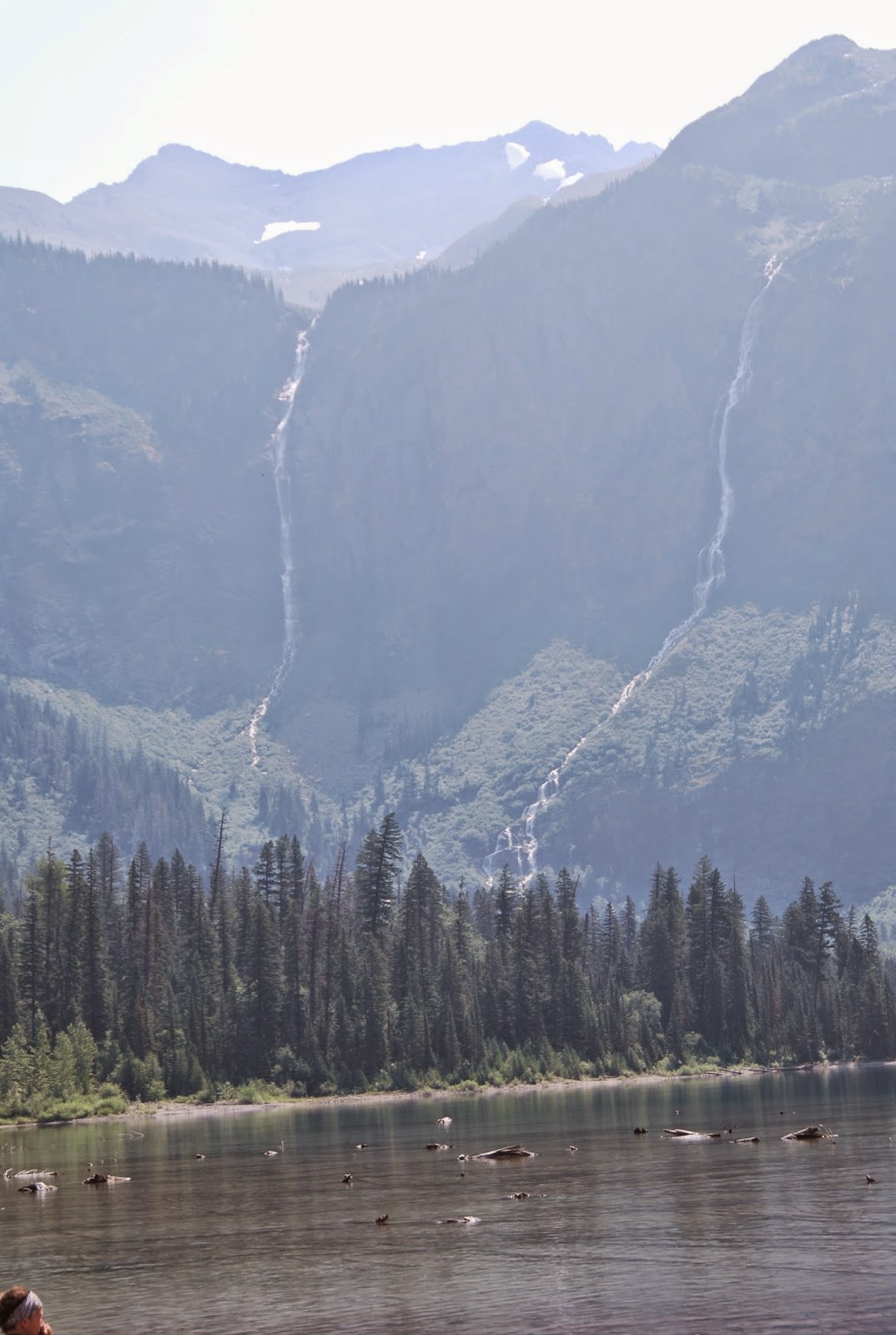
that knowledge, our goal for the day was to take two short hikes on the east
side of Glacier Park – St Mary’s Falls and Virginia Falls. The trail head is
accessed by going from West Glacier and up the Going-to-the-Sun road and down
the other side or by coming in from St Mary’s, which is way around the east
side. We chose the later.
The road around the south end of Glacier is quite pretty
with the mountains and trees. It also
takes time – about 2.5 hours – to get to the east side entrance. This is not a
quick trip.
At Marias Pass there is a monument to John Stevens, the
person that found a way through the mountains to the south of Glacier Park that
allowed the Great Northern Railroad to punch a rail line through from east to
west. This was in the 1889. (As a bit of trivia, he is also the engineer that
discovered through route through Stevens Pass in the Cascades and for whom the
pass is named.)
The Great Northern Railroad was instrumental in the
development of the grand lodges within the park, as Glacier became the
playground of choice. The construction of the snow sheds across the tracks
attests to the wild nature of the rail line in the winter. Until the 1910’s,
the railroad was used to ferry cars from one side of Glacier to the other, as
the road we were traveling did not exist. Pretty impressive when you see the
railroad is still in use today.
Once at St. Mary, we entered the park thinking we were not
that far away from our hike. That is
where luck, or lack of luck, came into play.
On a good day, parking is limited at the trail head. Today, not only was the parking full, with the road construction, parking was more limited than normal.
Hiking the two trails was not an option today, darn.
Heading toward Logan Pass, we thought we would stop at the
visitors center and walk up to the Hidden Lake overlook. That wasn’t an option either. The parking lot was full, as was every other
pullout or lookout. To say that the
park was crazy busy is an understatement! I will seriously consider taking the
shuttle through the park on any future visits to get to the various sites.
Wednesday, August 6, 2014
Avalanche Lake
It has been at least 24 years since we took this Glacier Park hike so we
were excited to walk the trail again.
This hike is one of the more popular hikes in the park,
according to the hiking guide. It is
easy and there is a lake at the end of it, making it worth the 3-mile trek
in. As a result, the trail is like
navigating the Renton S curves during rush hour traffic where, as one couple
from Alabama put it as they sat along the trail and observed the people, there
is absolutely no trail etiquette. Even with that, we managed to navigate the
trail in one piece and see the sights.
No surprise, the creek flows from the lake down to McDonald
Creek, which is where the trail begins.
The trail follows the creek most of the way offering plenty of waterfall
views, big and small.
Before we got too far into the trail, however, a warning was
posted that the trail from the end to the lake to the head of the lake was
closed due to Grizzly bear activity.
Even with bear spray hanging from our packs, there is no desire to run
into a Grizzly. No worries, there is
still plenty to see.
The prize at the end of this hike is the large lake
surrounded by canyon walls with water falls running down the side. The beauty of the area is awesome and hard
to capture in a picture on a clear day.
The fire haze made it that more difficult to really appreciate the
view.
Subscribe to:
Posts (Atom)